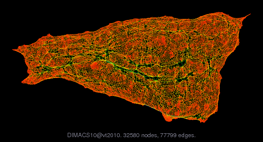
DIMACS10/vt2010
DIMACS10 set: redistrict/vt2010 and vt2010a
| Name |
vt2010 |
| Group |
DIMACS10 |
| Matrix ID |
2627 |
|
Num Rows
|
32,580 |
|
Num Cols
|
32,580 |
|
Nonzeros
|
155,598 |
|
Pattern Entries
|
155,598 |
|
Kind
|
Undirected Weighted Graph |
|
Symmetric
|
Yes |
|
Date
|
2010 |
|
Author
|
W. Zhao |
|
Editor
|
H. Meyerhenke |
| Structural Rank |
|
| Structural Rank Full |
|
|
Num Dmperm Blocks
|
|
|
Strongly Connect Components
|
1 |
|
Num Explicit Zeros
|
0 |
|
Pattern Symmetry
|
100% |
|
Numeric Symmetry
|
100% |
|
Cholesky Candidate
|
no |
|
Positive Definite
|
no |
|
Type
|
integer |
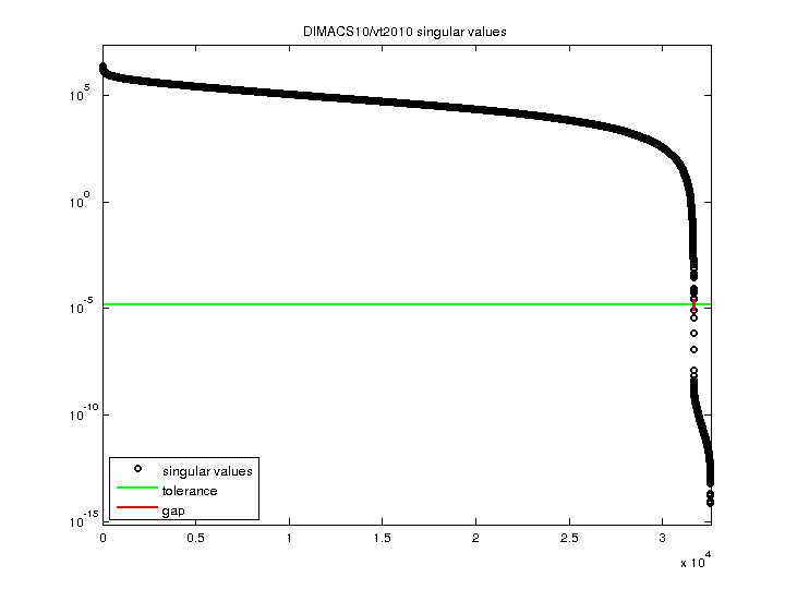
| SVD Statistics |
| Matrix Norm |
2.388892e+06 |
| Minimum Singular Value |
7.293416e-15 |
| Condition Number |
3.275409e+20
|
| Rank |
31,666 |
| sprank(A)-rank(A) |
|
| Null Space Dimension |
914 |
| Full Numerical Rank? |
no |
| Download Singular Values |
MATLAB
|
| Download |
MATLAB
Rutherford Boeing
Matrix Market
|
| Notes |
DIMACS10 redistrict set
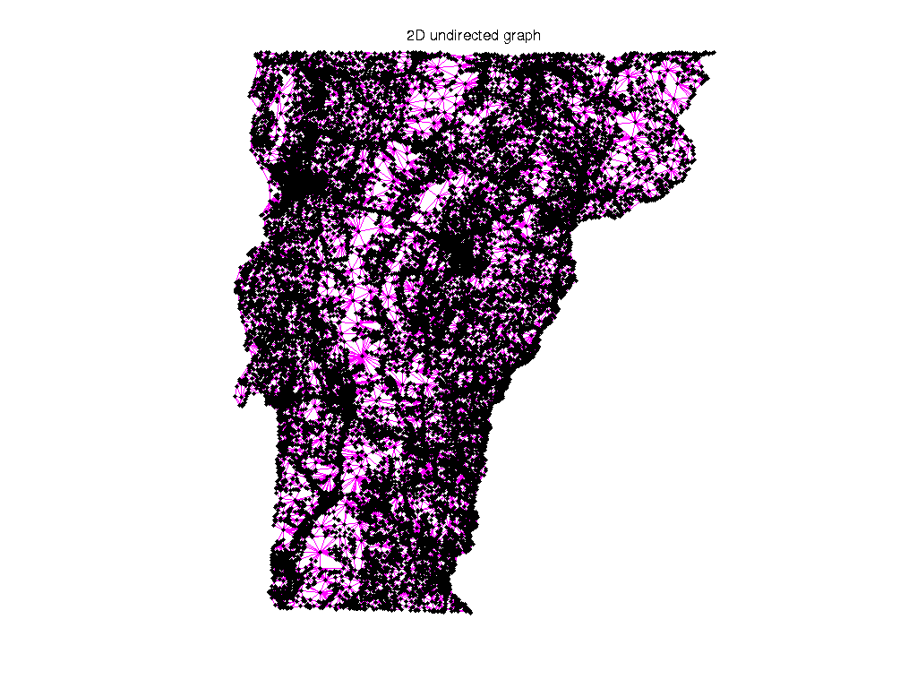
Redistricting and Graph Partitioning
====================================
The xx2010a graphs are generated from U.S. Census 2010 and Tiger/Line
2010 shapefiles. They are freely available from census.gov web site.
The xx prefix in the filenames are the U.S. Postal Service acronyms of
the state names, e.g. ny is New York.
* the vertices are the Census Blocks;
* two vertices have an edge if and only if the corresponding Census
Blocks share a line segment on their border, i.e. rook-style
neighboring.
* each vertex has two weights:
(1) Census2010 POP100 or the number of people living in that
Census Block, and.
(2) Land Area of the Census Block in square meters
* the edge weights are the pseudo-length of the shared borderlines.
The pseudo-length is calculated using sqrt(x^2 + y^2), x and y
being the differences in longitudes and latitudes of each line
segment on the shared borderlines. Then the result is multiplied
by 10^7 to make the edge weights integers.
* each Census Block gets identified by a point, and the XY coordinates
are the longitudes and latitudes of each point. The points are
selected by Census to be internal to the Census Blocks, but the
tech doc says that they are not always internal (but always very
close).
Author: Will Zhao
Added to the DIMACS10 collection by Henning Meyerhenke, 2011
The DIMACS10 collection also includes versions of these graphs with
unweighted edges. The two sets have been merged in this collection.
If you want the unweighted version, just drop the edge weights on the
graphs present in this collection.
|